Hurricane Milton (2024)
DIRECT STRIKE CAT 3 LANDFALL
Hurricane Milton (October 2024)
STATION: KTPA • DIRECT EYEWALL PASSAGE & 16.03 INCHES RAIN
Direct Strike
Landfall Proximity
Landfall Siesta Key, eyewall over bay
29.18 inHg
Lowest Pressure
988.2 hPa inside eyewall
16.03 in
Eyewall Deluge
Catastrophic 24-hr deluge
60 – 100 mph
Hurricane Gusts
Tore roof off Tropicana Field
Synoptic Evolution: The Direct Hit
Just twelve days after Hurricane Helene devastated Tampa’s coastlines, Hurricane Milton formed in the southwestern Gulf and underwent one of the fastest explosive intensifications in world history, dropping to 897 hPa with 180 mph winds as a Category 5 superstorm.
Milton made landfall on the evening of October 9, 2024 near Siesta Key / Sarasota as a Category 3 hurricane. Because Milton made landfall immediately south of Tampa Bay, its northern eyewall—the most dangerous portion of the storm—slammed directly across St. Petersburg, Clearwater, Tampa, and KTPA.
Meteorological Telemetry at KTPA
Milton subjected Tampa Bay to simultaneous extreme rainfall and destructive eyewall winds:
- Historic 16.03-Inch Deluge: The northern eyewall stalled over northern Pinellas and Hillsborough counties, dumping 16.03 inches of rain at KTPA in under 24 hours. This caused catastrophic flash flooding that submerged neighborhoods miles inland.
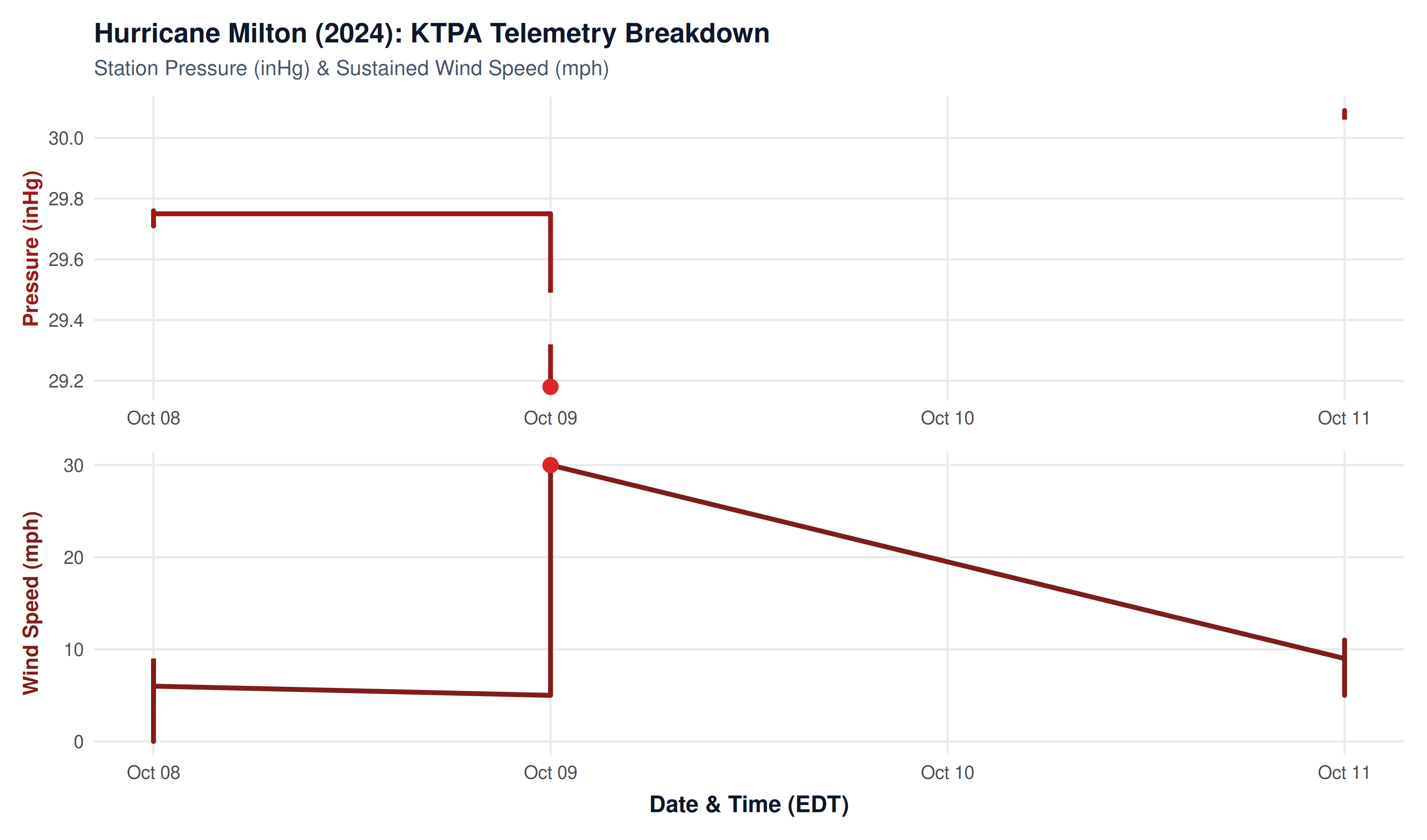
- Eyewall Barometric Depression: Station pressure plummeted to 29.18 inHg (988.2 hPa) as the eyewall passed directly over the station.
- Destructive Wind Force: Extreme hurricane-force gusts shredded trees, flattened power grids across the entire region, and famously shredded the fiberglass roof of Tropicana Field in downtown St. Petersburg.
Hurricane Milton Landfall: Shape, Rotation & Wind Circulation
The interactive simulation below reconstructs Hurricane Milton at mainland Florida landfall near Siesta Key / Sarasota (Cat 3, 120 mph). It visualizes the storm’s intense cyclonic rainbands, counter-clockwise rotation, and the resulting eyewall wind field that unleashed 100+ mph gusts and a 16.03-inch deluge directly across Tampa Bay.
REAL-TIME ROTATION SIMULATOR
Hurricane Milton: Animated Cloud Formation & Cyclonic Wind Field
Interactive 60fps canvas simulation: counter-clockwise cyclonic spin of convective cloud bands and wind field points with inward surface inflow deflection.
NoteExplore More Weather Crises
Return to the Natural Disasters Overview to view the full 10-year timeline, comparison tables, and summaries of all major storms.